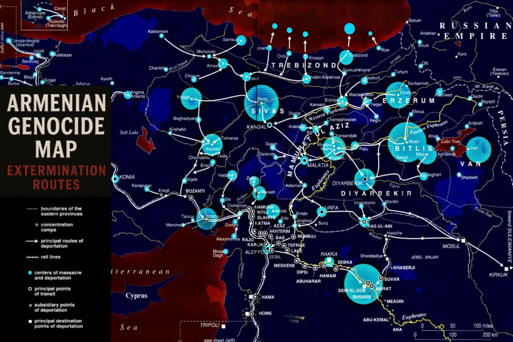
Maps of the Armenian Genocide: Deportation Paths, Extermination Routes And Concentration Camps
This growing collection of historical maps visualizes the systematic extermination of Armenians during the Armenian Genocide of 1915–1923. From forced deportation routes to death marches, concentration camps, and massacre sites, these maps provide crucial insight into the geographic scope and calculated nature of the genocide. Many include reconstructions based on survivor testimonies, archival data, and historical records. A special focus is placed on highlighting the destruction of Armenian communities stretching from Constantinople to the Anatolian plateau, and the vast displacement of women, children, and the elderly during the Ottoman Empire’s campaign of extermination. Each map is presented with historical context and figure-style captions to support both academic research and public education.